Visualizing Local Surveillance Infrastructure
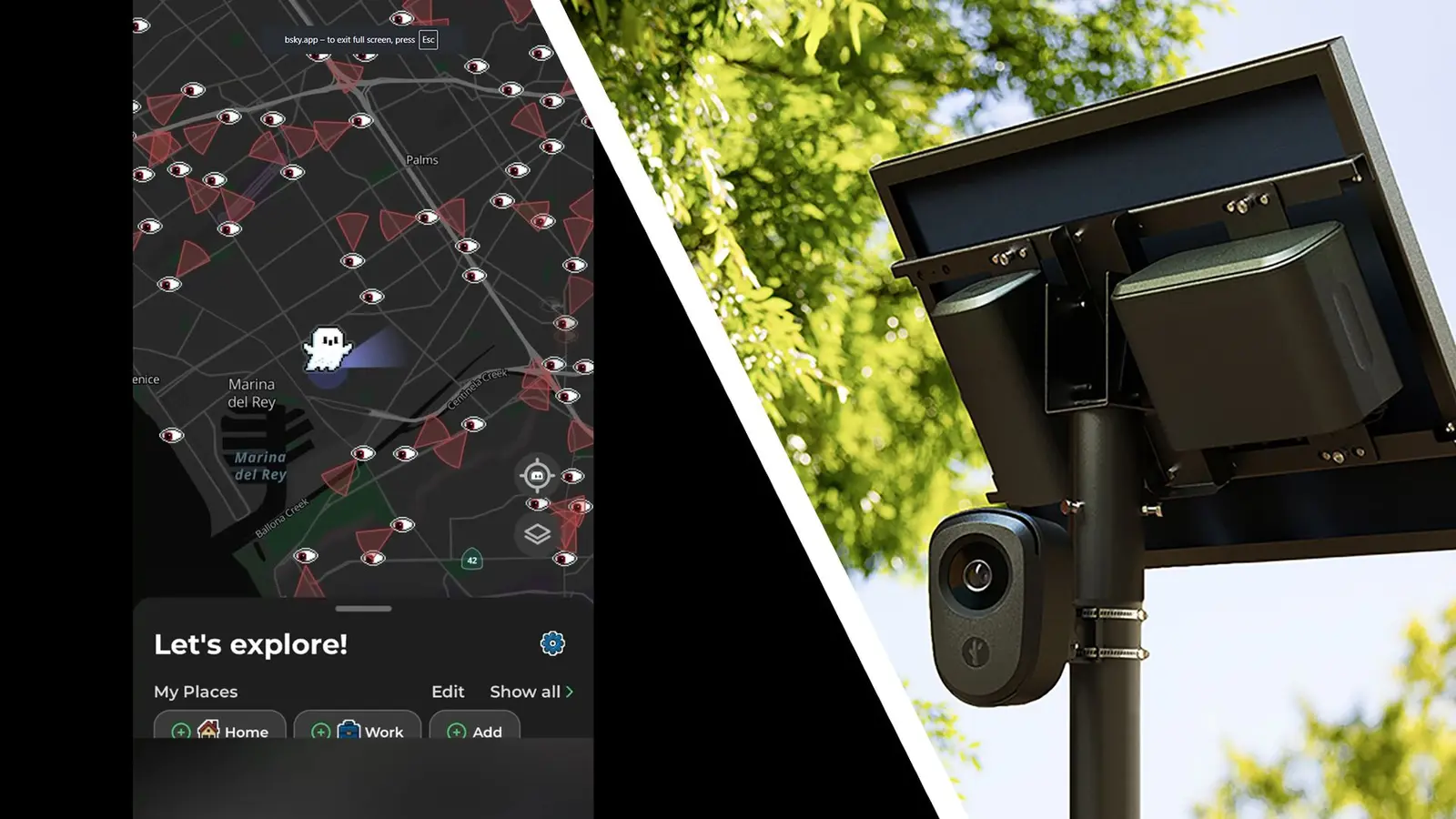
MapQuest has introduced a new surveillance feature to its mobile application. This update allows users to visualize the location of license plate readers. The data primarily comes from Flock, a major provider of automated vehicle identification technology. The feature is accessible on Android devices and aims to increase transparency regarding local monitoring infrastructure. This addition follows a recent surge in the platform's user base and popularity.
Latest news
 Anthropic Unveils Claude Duet For Background AI Tasks
 Eiliko Creator Hires Independent Security Firm After Flawy Robot Charm Exposed
 Musk Compares Optimus Robot Training to Raising a Toddler
 Atari VCS Software Store Closes in February 2027
The new layer displays specific coordinates for scanners installed across various jurisdictions. Users can toggle this view to see how densely populated their area is with surveillance hardware. The integration highlights the growing presence of automated traffic enforcement tools in public spaces. MapQuest leverages existing data feeds to present this information in a user-friendly format. The app now serves as a tool for civic awareness as well as navigation.
Why Transparency Matters for Drivers
The feature works by overlaying scanner locations onto the standard digital map interface. Each point represents a known installation of license plate recognition technology. Flock provides the core dataset, though other companies may contribute data in the future. This transparency helps residents understand the scope of automated monitoring in their neighborhoods. The visual representation makes abstract data tangible for the average user.
MapQuest has seen a significant increase in engagement recently. This growth was partly driven by the company's decision to ignore specific government mandates regarding lake naming. The platform chose to maintain its historical naming conventions rather than comply with recent administrative changes. This stance resonated with many users who valued consistency and heritage in geographic data. The new surveillance layer adds another dimension to the app's utility. It shifts the focus from pure navigation to civic information.
The rollout has received positive feedback from online communities. Many users appreciate the ability to see exactly where these devices are located. This knowledge allows drivers to stay informed about the technological environment they navigate daily. There is no indication that the feature will be used for enforcement purposes. It strictly serves as an informational resource for the public. The move aligns with broader trends toward open data and government transparency.
Frequently Asked Questions
Does MapQuest show all license plate scanners? The feature currently displays scanners from Flock and potentially other providers. It does not guarantee a comprehensive list of every single device in a region.
Is this feature available on all devices? The update is currently highlighted for Android users. Availability on other platforms may vary or be rolled out in subsequent updates.
Comments
Leave a comment